|
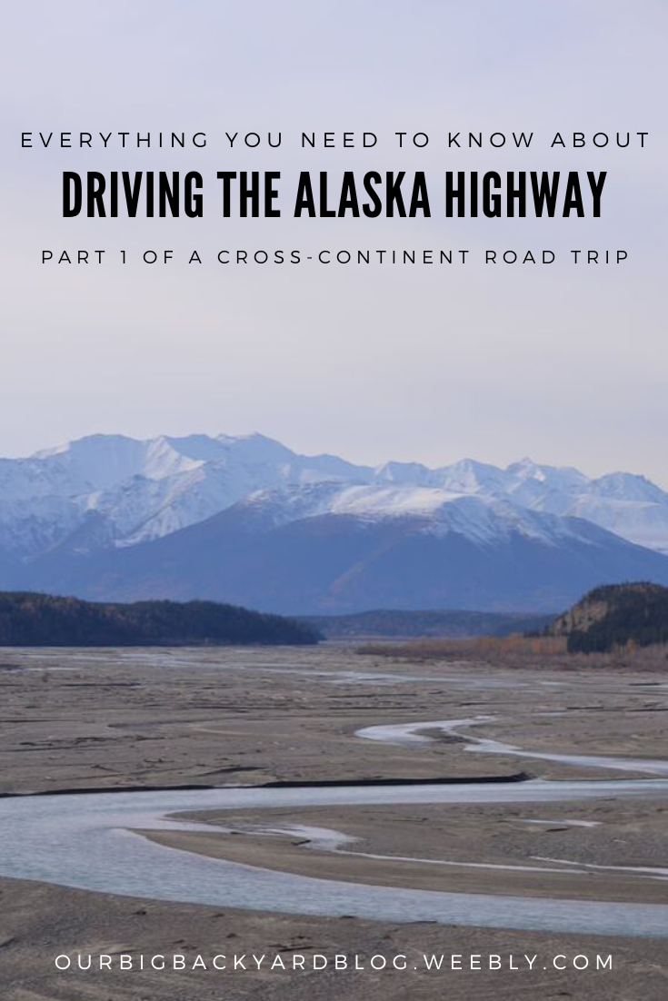
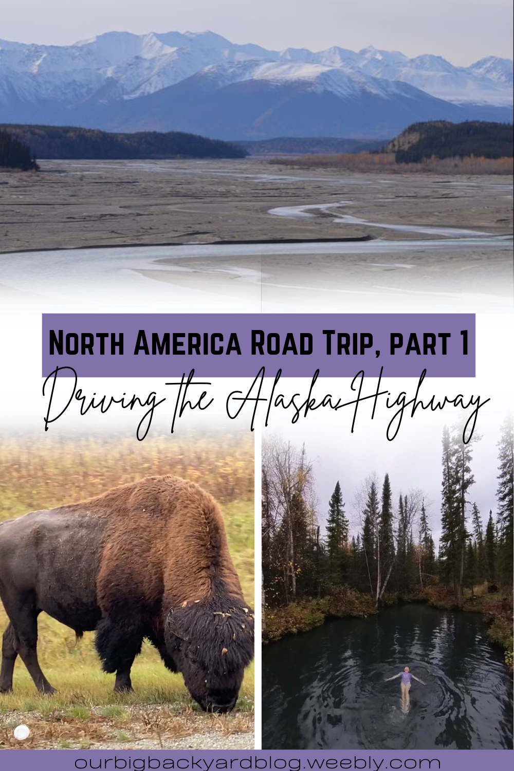
If you’re not following us on Instagram, you might’ve missed the news that we’ve moved! We received a new assignment with the military and had to say a bitter sweet goodbye to the Alaska life we have come to know and love. We’ve been trying to get our bearings in our new home in South Carolina for exactly 2 months now! We finally moved into our house a few weeks ago and felt like it was time to start writing about our cross country continent road trip! That’s right. On September 30, we packed up our truck and our travel trailer and set off on a grand road trip adventure (and lived to tell about it :) We took 31 days of slow traveling and saw some amazing things and made incredible memories. We’ve even had a few people asking about our trip in our instagram messages who are setting off to do the same thing very soon! So I hope this proves helpful! 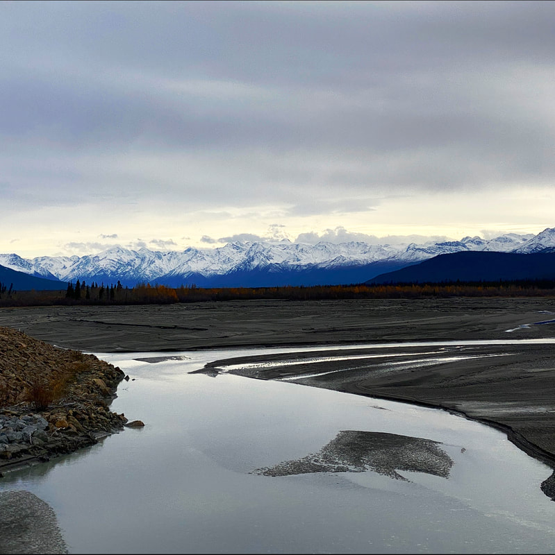 The first leg of our trip was the most intimidating, by far. We were driving the ~1500 miles of the Alaska Highway through the Yukon, on the cusp of winter no less. This meant that the already limited services and population was even more so. We had extra gas cans and extra tires. Winter regulations in Canada were in affect, which meant it was the law to have chains. Spoiler alert: we were incredibly lucky to have the experience we did because it is not for the faint of heart and for every good experience you hear, there are multiple bad ones. Fun facts: The Alaska Highway is incredibly historical. It was built during WWII to connect Alaska to the rest of the contiguous United States. Originally, it was built by American troops, which is why it has “mile” markers, as well as kilometers. Because it was a military road, it wasn’t open to civilians for some time after it was built. Now, it is a regularly used route that is maintained by Canada.  Day 1Due to some military rules, we weren’t allowed to cross the border into Canada until Oct 1 so our drive on Sept 30 started in North Pole, Alaska and ended in Tok, Alaska. Starting off with a short 3 hour drive and putting us about 90 miles from the Canadian Border. 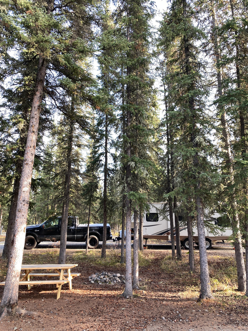 Tok (pronounced like toke) has a population of 1214 and was put on the map during the construction of the Alaska Highway in the early 1940s. Historically (and today) it has been a trade center for the Athabaskan villages of Northway, Tetlin, Tanacross, Mestasta, Eagle, and Dot Lake. It’s a great jumping off point for many backcountry Alaskan adventures since it’s the gateway to Alaska for those driving (and for bush pilots). For one of our favorite adventures near Tok, check out our post about our trip to Chicken! This trip was obviously just for a stop over - it was also outside of tourist season so much was closed down - so we didn’t do any sight seeing. We stayed at Tundra RV Park, which was very pretty and well maintained. Again, since we were visiting in what is considered the winter season, some amenities weren’t available, namely water hookups had been shut off due to below freezing temperatures creeping in at night. We were prepared though, with our trailer fully stocked. We had a beautiful drive, temperatures in the 40s and bluebird skies. We did see some snow on the ground outside of Delta Junction, which we were happy to wave goodbye too :D.  Day 2Our second day was another pleasant drive, though I do want to put in a little disclaimer here: when we bought our trailer, we bought it from a couple that had done this drive a few times. He recommended to take off the plastic fender wells off the trailer due to the rough roads. While the road is technically maintained, it’s not easy driving - though not much different than other roads we were used to driving in Alaska ;) This is because of the frost heaves. Because of the extreme temperatures, the ground freezes and thaws throughout the year causing the roads to sink and rise frequently in many places. All that to say, what google said was a 6 hour drive to our next stop in Haines Junction, ended up being 8. It was fun to spot all the trumpeter swans and we also saw a grizzly bear on the side of the road!
A couple roadside attractions during the drive included stopping for a few pictures at the Canadian Border. If you notice, in the picture behind my girls, you can see a wide clearing of trees - this is the maintained border that Canada and the US keeps clear. Pretty crazy to see such a distinct line in what is otherwise regarded as untouched wilderness.  Another quick stop was Burwash Landing to see the world’s largest gold pan. Burwash Landing is a small community on the shore of Kluane Lake. It is one of the oldest settlements in Yukon, established in 1904 as a supply center for local miners. The Kluane Museum of Natural History is here, though it was closed for the season in October. There’s also Our Lady of the the Holy Rosary Mission, built in 1944, the first church on the Alcan Highway.  We stayed the night at the campground behind Kluane Park Inn in Haines Junction. They were very nice and accommodating though we did kind of regret not listening to others advice to hold out until Whitehorse and just camp there haha. Haines Junction itself might be a little run down but I will say, it has some gorgeous views being just outside of Kluane National Park. Again we had no water hookups at the campground due to the season. One thing of note: we asked at the border if we could exchange US money to Canadian and they told us the closest place to exchange money was in Whitehorse. The showers at the campground in Haines Junction only took “loonies” but they were happy to exchange quarters for us at the front desk. 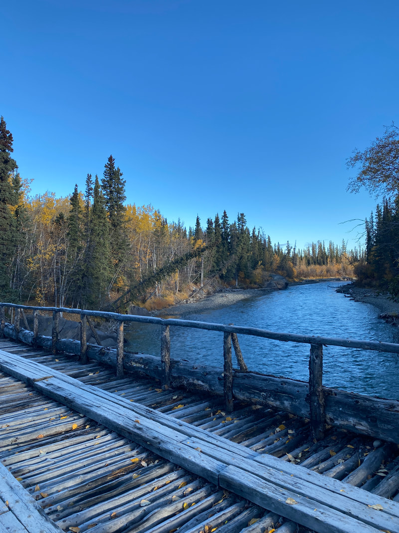 day 3Our first highlight of day 3 was a big bull moose crossing the road right in front of us just outside of Haines Junction. You may think we would get used to seeing moose after living in Alaska for 4 years, but it never gets old seeing these majestic creatures. Also, in the 4 years of living in Alaska, this was really my only good view of a big bull moose! So that was exciting to finally see. We also stopped at this little picturesque spot at the historic Canyon Creek Bridge. In 1904, a year after the Kluane gold strike, a log bridge was built across the Aishihik River, or Canyon Creek. It became a very important link on the wagon road connecting Whitehorse to Silver City. It survived heavy traffic and high spring floods until the 1920s when the government contracted it to be rebuilt. Then, again, during the construction of the Alaska Highway in 1942, the bridge was dismantled and a new one was hand-built in 18 days and then abandoned when the road was rerouted the next year. The old pioneer bridge was left in place and reconstructed in 1986 with 10% of the original bridge and 85% of the cribbing. 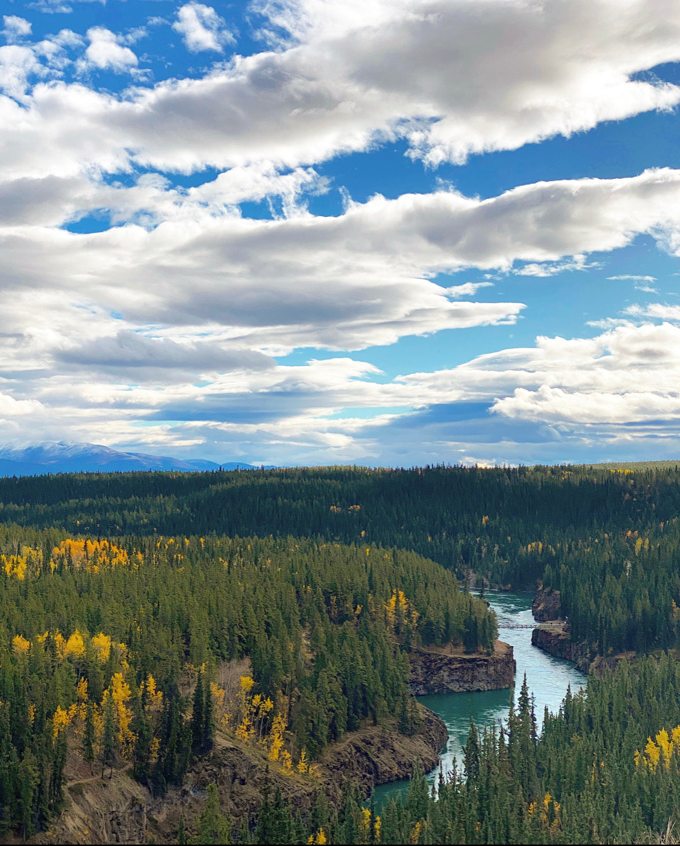 We stopped in Whitehorse for a few hours, which is the capital of Yukon. Whitehorse is a beautiful city on the banks of the Yukon River. It’s a very historical city as it was a major stop for prospectors in the Yukon Gold Rush. Fun fact: Right outside of town were some pretty heavy rapids that were so dangerous, the mounties made it illegal for women to stay in the boat for the ride. Men would build a raft and attempt the rapids with all their supplies while the women would have to get out and walk around - though there are a few women of note who braved the rapids at risk of life/a hefty fine. The rapids are now covered by a power plant but there are many historical sites around town, though a lot, again, were closed for the season which was disappointing because I am super into history! It was fun to walk along the river though, and try to imagine what it might’ve looked like 100 years ago. We stayed in Whitehorse a little longer than we planned because we had discovered an issue with the electric brakes on the trailer. It was a holiday in Canada though, so all the RV service centers were closed. We ended up having to move on and hope to get it fixed later. 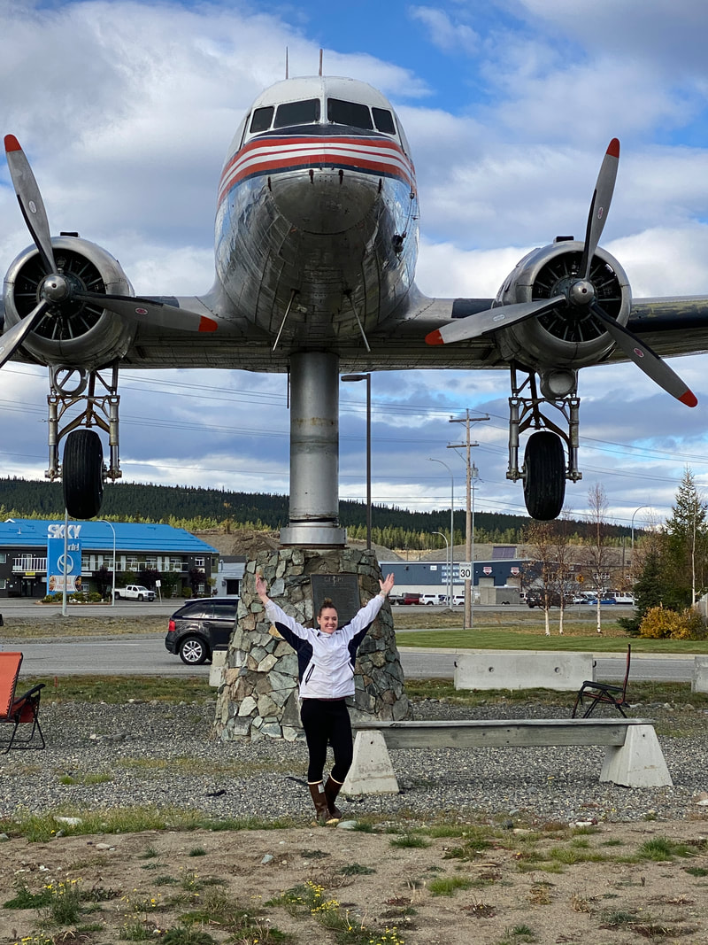 World's Largest Weather Vane; a retired Douglas DC-3 airplane; Whitehorse, Yukon We didn’t have cell service once we made it to our stop for the night in Watson Lake though we did have water hookups! We stayed the night at Nugget City RV Park, which was technically closed for the winter but they did have a few spots to hook up next to the store/cafe. They prefer to take cash and they did take US dollars - since we forgot to exchange while we were in Whitehorse :/ We had been enjoying the increasingly warmer fall weather especially after seeing that we missed the first snow storm to hit North Pole. After 3 days, we officially hit the halfway point of the Alaska Highway!
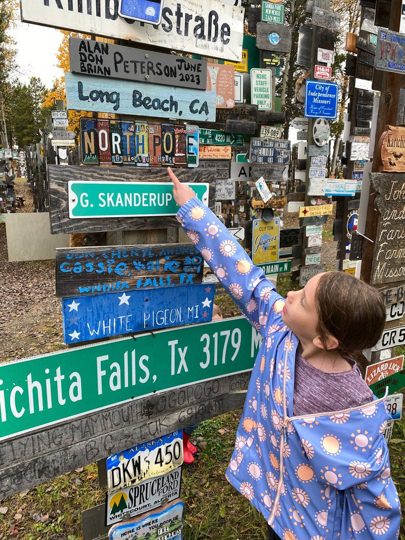
day 4Day 4 was a bit of a doozy of a drive since we were dealing with brake issues, but we also had a few fun pit stops! We started off wandering the Sign Post Forest in Watson Lake. The Sign Post Forest is one of the top attractions along the Alaska Highway. It began in 1942 when a soldier was asked to repair some directional signposts, and while he did, he decided to add a sign for the direction and mileage to his hometown in Illinois. Others followed suit and the rest is history! Today, there are over 77,000 signs and growing. The town of Watson Lake continuously adds more sign posts as they fill up. We didn’t bring a sign to add to the forest but we did a little scavenger hunt to find licenses plates from all 50 states and all Canadian Provinces. We would’ve been successful except that we were missing one state!! And of course the only state we couldn’t find was South Carolina - the place we were moving too :D 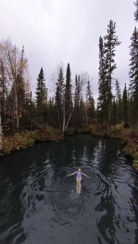 Our next stop was a quick dip in the Liard Hot Springs. At mile marker 475 - almost 100 miles from the closest amenities, travelers will find the beautiful Liard River Hot Springs. Originally used as a traditional cleansing spot by the Athapaskan and Kaska people as early as 10,000 years ago, these hot springs are the second largest in Canada and are ranked among the top 5 hot springs in the country. We entered the park and paid for parking, walked through the electric fenced - gated off for bears that like to frequent the area - and walked the scenic boardwalk all the way to the springs. It is a beautifully maintained area equipped with dressing rooms. Definitely a required stop along the Alaska Highway. 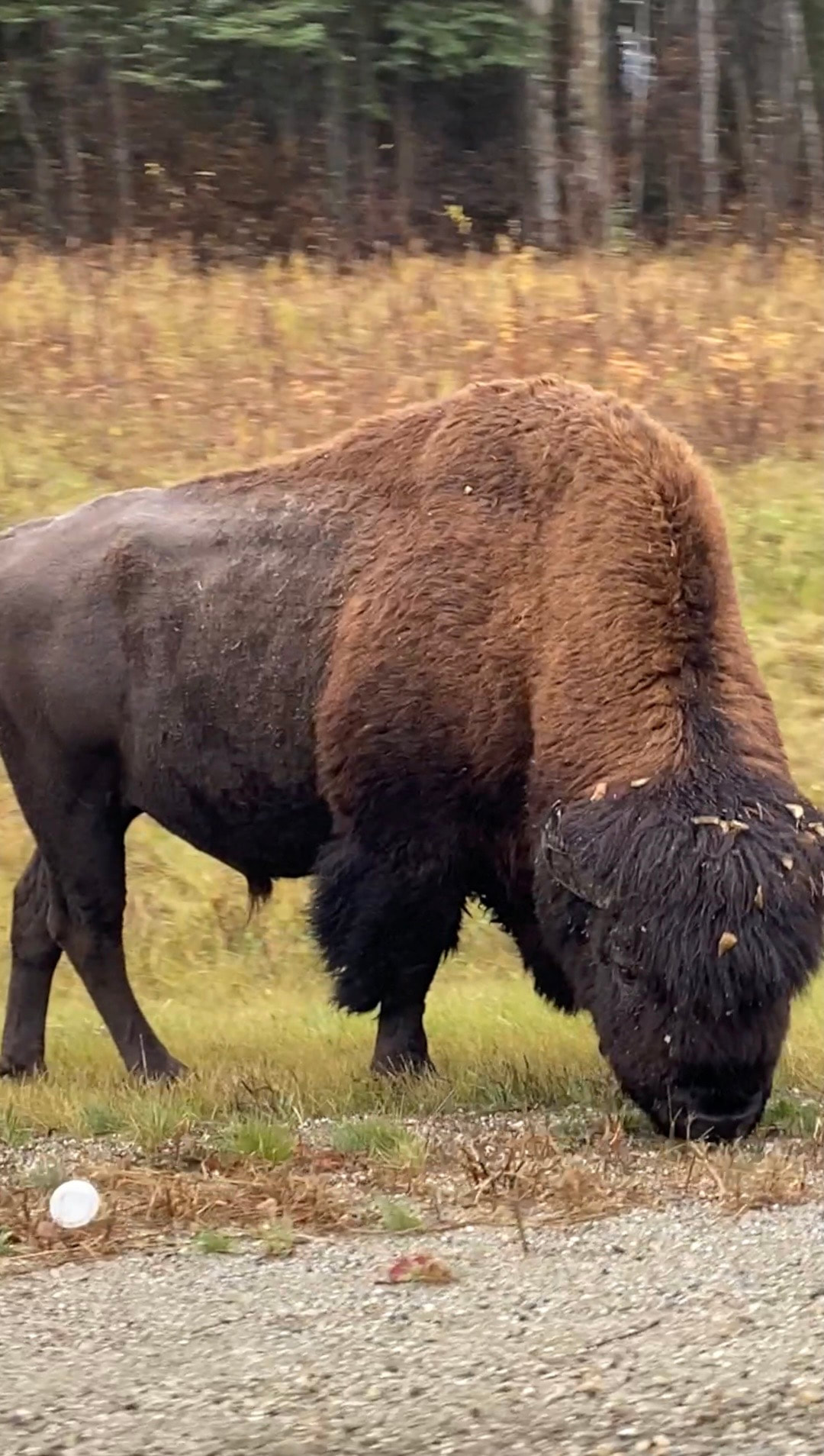 That night, we stopped in Fort Nelson, BC. You can tell when you pass into British Columbia because you immediately start seeing bison on the side of the road! We counted 26 bison on our drive, as well as 2 black bears and 1 elk! Which was fun because it’s too cold for elk in Fairbanks/North Pole. We stayed at Triple G Hideaway Campground, which was an amazing campground and quite honestly, the nicest campground bathrooms I have EVER seen, haha. The kids enjoyed the little swings while we set up and took down camp.  day 5We completed the Alaska Highway portion of our drive!! We definitely had to stop and hang out in Dawson Creek to mark the momentous occasion! Right at the sign, there’s a cool little train/history museum that we walked through just before closing time. We also stopped for some burgers and poutine at Post & Row for dinner. Poutine is a classic Canadian comfort food dish made of French fries covered in brown gravy and cheese. It is very delicious! That night, we stopped in Grande Prairie, AB. On our drive we noted the extremely improved driving conditions compared to the last few days and made good time. We also noticed that towns and cities are getting bigger and closer together - we were a little blown away to pull into Grande Prairie and see all the city lights :D Almost 1500 miles under our belt marks about 1/3 of our whole trip and we’re not even through Canada yet. I was very intimidated planning this portion of our trip. How was I going to entertain my 3 young kids and keep everyone happy during a long, boring trip through Yukon backcountry? But I purchased the Milepost 2023 and immediately was so excited. It was actually a very interesting read and was fun to follow along as we drove. It lists each mile post, each stop for services, it even list all the pull outs, which is very helpful when you don’t have cell service. It has a little write up about the historical spots and little maps of each town you pass through. It was incredibly helpful and interesting and I highly recommend it. Though, side note: if you are using it to get from Alaska to the lower 48, you do have to read it backwards, which makes things a little more interesting, haha. That concludes the first leg of our trip! You can read part 2 here. Our visit to Grande Prairie was not uneventful in the least (insert sly face emoji). Have questions about driving the Alaska Highway? We’re always happy to answer! Or if you’ve done this route, is there anything you would add that we might’ve missed?? If you’re interested in a one-on-one chat to help plan a custom trip to (or from) Alaska, check out our options here! Make sure to pin so you can come back to this post! Don’t forget to follow us on Instagram or TikTok for some of our day-to-day adventures and until next time, get out and explore where you live!
1 Comment
Sherrelyn
1/10/2024 02:30:01 pm
I love the details and your attention to history. I'm sure pictures don't do it justice, but from my laptop the scenery is swoon-worthy. Can't wait to read part 2! Leave a Reply. |
AuthorWe're just a military family enjoying where we live, one PCS at a time. Follow us as we explore our current home, South Carolina, and beyond. The world is our backyard. Archives
June 2024
Categories
All
|


 RSS Feed
